 FAO Map Catalog
OKACOM - The Permanent Okavango River Basin Water Commission
Type of resources
Available actions
Topics
Keywords
Contact for the resource
Provided by
Representation types
Update frequencies
status
Scale
-

This raster layer (90m resolution) identifies stream segments in the CORB-Contributing area. Each segment has a specific grid code, which will be fundamental in later modelling of the hydrological network. Source: This layer was created by computations of the Flow Direction and Stream Segmentation raster grids. This dataset is part of the GIS Database for the Environment Protection and Sustainable Management of the Okavango River Basin project (EPSMO). Detailed information on the database can be found in the “GIS Database for the EPSMO Project†document produced by Luis Veríssimo (FAO consultant) in July 2009, and here available for download.
-
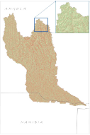
This vector layer (polygon) - reference scale 1/200 000 - also identifies the catchment area for each stream segment in the CORB-Contributing area. The value for each polygon corresponds to the value carried by the stream segment that drains that area, defined in the Stream Segmentation grid. Source: This layer was created by converting the Catchment Grid raster layer into vector format. This dataset is part of the GIS Database for the Environment Protection and Sustainable Management of the Okavango River Basin project (EPSMO). Detailed information on the database can be found in the “GIS Database for the EPSMO Project†document produced by Luis Veríssimo (FAO consultant) in July 2009, and here available for download.
-
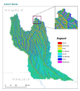
Delineation of aquifer systems in Angola, that share geographical overlapping with the Okavango Basin. Source: Generated for the EPSMO project based on hydrogeological map of Angola provided by Direccao de Geologia e Minas at 1/1000000. This dataset is part of the GIS Database for the Environment Protection and Sustainable Management of the Okavango River Basin project (EPSMO). Detailed information on the database can be found in the “GIS Database for the EPSMO Project†document produced by Luis Veríssimo (FAO consultant) in July 2009, and here available for download.
-
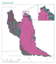
This vector layer represents the geologic units in the CORB-Contributing area of Angola. Source: Data provided by SINFIC, based on the Topographic Map of Angola (Laboratorio Nacional de Investigação Científica Tropica, 1982). This dataset is part of the GIS Database for the Environment Protection and Sustainable Management of the Okavango River Basin project (EPSMO). Detailed information on the database can be found in the “GIS Database for the EPSMO Project†document produced by Luis Veríssimo (FAO consultant) in July 2009, and here available for download.
-
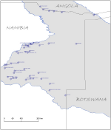
This layer represents the spatial distribution of rain measuring stations, in Namibia, that share geographical overlapping with the Okavango Basin. Source: Ministry of Agriculture, Water and Forestry of Namibia. This dataset is part of the GIS Database for the Environment Protection and Sustainable Management of the Okavango River Basin project (EPSMO). Detailed information on the database can be found in the “GIS Database for the EPSMO Project†document produced by Luis Veríssimo (FAO consultant) in July 2009, and here available for download.
-

Delineation of power lines in Namibia, that share geographical overlapping with the Okavango Basin. Source: Ministry of Agriculture, Water and Forestry of Namibia. This dataset is part of the GIS Database for the Environment Protection and Sustainable Management of the Okavango River Basin project (EPSMO). Detailed information on the database can be found in the “GIS Database for the EPSMO Project†document produced by Luis Veríssimo (FAO consultant) in July 2009, and here available for download.
-

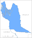
This vector layer (line) – reference scale 1/200 000 – is a drainage network model of the CORB-Contributing area. In the attributes table, each drainage line is linked to the micro catchment in which it resides. The creation of this layer was achieved by converting the Steam Segmentation grid layer into vector layer. This dataset is part of the GIS Database for the Environment Protection and Sustainable Management of the Okavango River Basin project (EPSMO). Detailed information on the database can be found in the “GIS Database for the EPSMO Project†document produced by Luis Veríssimo (FAO consultant) in July 2009, and here available for download.
-
This raster layer represents the aspect model of the CORB-Contributing area, in the reference scale of 1/200 000. Aspect is the direction that a slope faces. It identifies the steepest downslope direction at a location on a surface. Source: The creation of this layer was achieved by interpolating the DTM raster layer. This dataset is part of the GIS Database for the Environment Protection and Sustainable Management of the Okavango River Basin project (EPSMO). Detailed information on the database can be found in the “GIS Database for the EPSMO Project†document produced by Luis Veríssimo (FAO consultant) in July 2009, and here available for download.
-

A set of 15 raster layers representing the monthly, annual, mean and average temperature for the Okavango Rive Basin. Source: Africa Water Resources Database (FAO). This dataset is part of the GIS Database for the Environment Protection and Sustainable Management of the Okavango River Basin project (EPSMO). Detailed information on the database can be found in the “GIS Database for the EPSMO Project†document produced by Luis Veríssimo (FAO consultant) in July 2009, and here available for download.
-
A set of 6 medium scale (250k) topographic maps, that share geographical overlapping with the Okavango Basin. Source: The Surveyor General, Harare, Zimbabwe. Original data georeferenced under the GIS EPSMO program. This dataset is part of the GIS Database for the Environment Protection and Sustainable Management of the Okavango River Basin project (EPSMO). Detailed information on the database can be found in the “GIS Database for the EPSMO Project†document produced by Luis Veríssimo (FAO consultant) in July 2009, and here available for download.